|
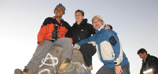
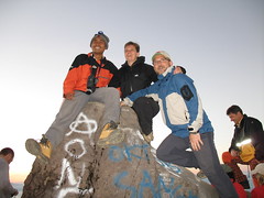
This is the most [’]exhilirating trekking experience[’] in Bali. It is not for those with a fear of heights [the faint hearted] but for those adventerous enough to conquer ‘the’ mountain. The reward will be memories that will last a lifetime.
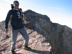
The second peak of Gunung (Mount) Agung is said to be 3142m. high, athough some say it lost its top in the eruption of 1963. The summit is an oval crater, about 700m. across, with its hightest point on te western edge above Besakih. In the eruption of 1963 upto 2000 people lost their lives, 100,000 lost their homes and the lava reached the sea, isolating Eastern Bali for some time. The entire island was covered with ash and crops were wiped out everywhere.
TWO ALTERNATIVE ROUTES TO THE SUMMIT ARE OFFERED:
1] MOUNT AGUNG STARTING FROM PASAR AGUNG TEMPLE
This trek involves the least walking as it starts from 1500m, reached
from a good road North from Selat. Pick-up from the hotel at 2:00am
and drive for one hour. A walk of 3 hours will see us at the summit in
time for the sunrise. Return to the hotel by mid-day. Highlights emerge from the clouds and understand why Bali is called ‘The island of the Gods’
see the remnants of 1963 lava flow
see the clouds from above, and the villages below
the breathtaking and unforgettable view of the sun rising over Mount
Rinjani, the highest mountain on the neighbouring island of Lombok.
2] MOUNT AGUNG STARTING FROM DUKUH VILLAGE
A more adventerous trek with an overnight camp, starting from Dukuh village, located in the Kubu District to the North of Mount Agung, more info .....
|